

Imara Africa Safaris
Tanzania

梅鲁山

攀登新的高峰,体验梅鲁山顶峰的刺激和坦桑尼亚的美丽风景。

探索坦桑尼亚第二高峰梅鲁山,这座东非最壮观的徒步目的地之一。梅鲁山位于阿鲁沙国家公园内,拥有令人叹为观止的自然风光、丰富的野生动物、壮丽的火山地貌以及乞力马扎罗山的迷人景色。梅鲁山常被认为是攀登乞力马扎罗山前的理想适应性训练山,它将带您穿越茂密的森林、开阔的沼泽地和崎岖的高山地带,体验难忘的徒步之旅。由于游客较少,您将有机会邂逅令人惊叹的野生动物,并饱览山顶全景,梅鲁山对于自然爱好者和徒步爱好者来说都是一次难忘的探险之旅。

1 Wildlife2 Highlights
梅鲁山

About 梅鲁山

Tanzania · Safari Destination

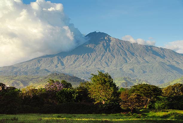
梅鲁山是坦桑尼亚最壮观的自然地标之一,也是徒步爱好者的世外桃源。它海拔4566米(14980英尺),是坦桑尼亚第二高峰,仅次于乞力马扎罗山,也是非洲第五高峰。梅鲁山位于阿鲁沙国家公园内,将野生动物观赏、风景优美的徒步旅行和令人叹为观止的火山地貌完美结合。

这座山是一座休眠的层状火山,数千年前曾喷发,形成了壮观的马蹄形火山口和崎岖的山脊。肥沃的山坡孕育着茂密的森林、丰富的野生动物和生物多样性,使其成为东非风景最优美的徒步旅行目的地之一。

与许多登山徒步路线不同,攀登梅鲁山的旅程始于在阿鲁沙国家公园的徒步旅行。

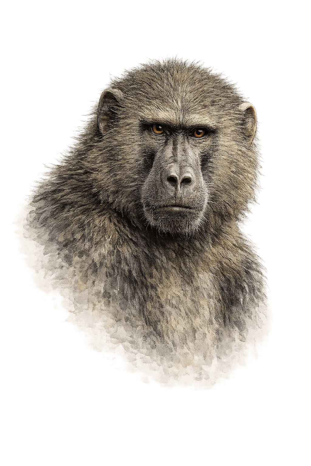
徒步者在进入山体森林覆盖的山坡之前,可能会遇到长颈鹿、水牛、斑马、疣猪、疣猴、狒狒和众多鸟类。由于野生动物出没,武装的公园护林员会在较低路段陪同登山者。

随着登山者不断攀登,他们会穿越多个生态区域,包括茂密的山地森林、石楠地、沼泽地、高山沙漠和岩石嶙峋的山顶地形。多样化的环境造就了不断变化的景观,为整个旅程提供了绝佳的摄影机会。

山顶被称为社会主义峰,登山者可以在这里欣赏到乞力马扎罗山、东非大裂谷和坦桑尼亚北部火山地貌令人叹为观止的日出美景。许多登山者认为山顶全景是东非最美的景色之一。

梅鲁山通常被用作攀登乞力马扎罗山前的适应性训练山。

然而,对于那些寻求挑战性徒步路线、希望避开人群、欣赏绝美风景的旅行者来说,它本身也是一次令人难忘的独立探险之旅。

无论您是准备攀登乞力马扎罗山、寻求独特的登山探险,还是探索坦桑尼亚北部的自然奇观,梅鲁山都能为您提供非洲最令人难忘的徒步体验之一。

Things to Do

1 activities & experiences

远足

Highlights

01风景优美的景色
02山地徒步

At a Glance

Wildlife: 1 species
Photos: 5
Safari Planning

Best Time to Visit 梅鲁山

Month-by-month guide with live weather, crowd levels, and seasonal highlights for 梅鲁山, Tanzania.

Dry SeasonMixed / Short RainsGreen Season (Rains)Current Month

July

Crisp, cool weather provides ideal, sweat-free conditions for the steep climb up to the dramatic crater rim.

Dry Season 11–21 °CHigh Season Peak Pricing

Best For

Summit TrekkingGame DrivesWalking Safaris

Monthly Rainfall

Minimal rain — great visibility

Live Weather · 梅鲁山

Live
2°C

few clouds · Feels 2°C

Humidity

80%

Wind

3 km/h

Feels

2°C

Live weather via OpenWeather — updated every 5 min.

When to Visit

Recommended travel months

攀登梅鲁山的最佳时间是6月至10月以及12月至次年2月的旱季。这些月份气候条件最佳,天空晴朗,能见度极佳,还能欣赏到乞力马扎罗山的壮丽景色。

Climate & Weather

Year-round weather patterns

梅鲁山的气候条件随海拔高度而变化。低海拔地区通常温暖潮湿,而高海拔地区则可能寒冷,尤其是在山顶附近。

Location & Getting There

梅鲁山, Tanzania

梅鲁山

Tanzania

Coordinates

-3.23928°, 36.76270°

Open in Google Maps

Getting There

Routes, transfers & access information

梅鲁山位于阿鲁沙国家公园内,距离阿鲁沙市约15公里,距离乞力马扎罗国际机场约60公里。其便利的地理位置使其成为坦桑尼亚最容易到达的山地目的地之一。

梅鲁山的地形包括茂密的山地森林、火山脊、岩石斜坡、开阔的沼泽地、高山沙漠和陡峭的山顶。登山者在攀登过程中会遇到各种各样的景观和生态区域。

The Big Five & More

Wildlife in 梅鲁山

1species documented — spot Africa's most iconic creatures up close.

Other Wildlife

Safari Vehicles for 梅鲁山

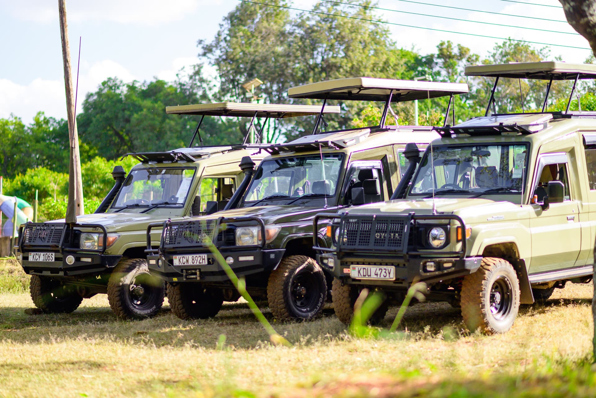
1 purpose-built vehicle— fully insured & maintained

Accessibility

Mount Meru is easily accessible by road from Arusha and Kilimanjaro International Airport. Standard vehicles can comfortably reach Momella Gate, the primary starting point for Mount Meru treks, via well-maintained roads within Arusha National Park.

For lodge transfers, safari extensions, and travel during rainy seasons, 4x4 vehicles are recommended for additional comfort and flexibility. Once inside the park, all mountain exploration is conducted on foot under the guidance of professional mountain guides and armed park rangers.

4×4 Safari 陆地巡洋舰
01

4×4 Safari 陆地巡洋舰

丰田78系列——狩猎驾驶专家

7 - 8 guests 4x4 Safari Land Cruiser
View Details Insured

Written and reviewed by Imara Africa Safaris’ Nairobi-based safari specialists, who plan and guide trips to 梅鲁山 throughout the year. Park fees, seasonal conditions and access details are checked against official park and tourism-board sources. .

梅鲁山常见问题解答

“Imara” means strongin Swahili. We build every safari with that same strength — expert knowledge, honest pricing, and relentless attention to detail.

Imara Africa Safaris

Ready for the trip of a lifetime?

Tell us what you're looking for and we'll build a custom itinerary — free, no obligation, within 24 hours.

Start Planning

No spam, ever. Unsubscribe anytime.

Safari AI Expert Live

Instant safari advice — 24/7

Ask me anything about safaris, destinations, wildlife or planning your trip.

Open Safari AI Expert

Chat with us

Online now

Our safari experts are ready to help you plan the perfect African adventure.